| |
| CERSER POB 672 ECSU Elizabeth City, NC 27909 vox: 252.335.3992 fax: 252.335.3572 |
|
|
|
|
|
| Center for the Remote Sensing of Ice Sheets (CReSIS) - https://www.cresis.ku.edu |
 The determination of the growth or shrinkage of ice sheets has acquired special urgency because of recent observations of unexpected glacier retreat, ice shelf collapse, and change in ice stream velocities in Antarctica and a few outlet glaciers in Greenland. The rates at which the ice sheets acquire or lose volume are affected by daily and seasonal variations in snowfall, snow drift, temperature, and other weather and climate variables. In turn, accumulation and loss rates will affect the contribution of the ice sheets to sea level. The determination of the growth or shrinkage of ice sheets has acquired special urgency because of recent observations of unexpected glacier retreat, ice shelf collapse, and change in ice stream velocities in Antarctica and a few outlet glaciers in Greenland. The rates at which the ice sheets acquire or lose volume are affected by daily and seasonal variations in snowfall, snow drift, temperature, and other weather and climate variables. In turn, accumulation and loss rates will affect the contribution of the ice sheets to sea level.
Because of the possible effects on coastal regions and populations of sea level rise, scientists are in need of tools and models that will help them measure and predict the response of ice sheets to climate change. This is a complex problem that demands the active collaboration of scientists and engineers to produce useful remote sensing and field observations, to find a satisfactory way of combining and interpreting them, and to develop new technologies, and models.
As a result, the National Science Foundation established the Center for Remote Sensing of Ice Sheets (CReSIS) as a Science and Technology Center (STC) in 2005. The center combines the expertise of researchers from six universities and several businesses in order to study and conduct research that will result in the technology necessary to achieve a better understanding of the mass balance of the polar ice sheets and its contribution to global climate change. |
| Polar Grid - http://www.polargrid.org |
 Polar Grid will deploy the Cyberinfrastructure which provides the polar community with a state-of-the-art computing facility to process the large volumes of data to be collected by CReSIS field operations and support large-scale ice-sheet models. Polar Grid will deploy the Cyberinfrastructure which provides the polar community with a state-of-the-art computing facility to process the large volumes of data to be collected by CReSIS field operations and support large-scale ice-sheet models.
In past years, most of the data collected in the polar regions were not processed in real time. Instead, data were shipped to computing facilities in the continental US and analyzed well after collection. Real-time processing and data analysis are urgently needed, both in the field and at supporting computing centers, to adjust collection strategies in response to new information contained in the data.
The polar community must have access to a state-of-the-art computing facility to process the large volumes of data to be collected by the polar community in 2007-08 as a part of the International Polar Year (IPY) activities, and to support large-scale ice-sheet models.
The field program consist of coordinated satellite, airborne and in situ measurements. Satellite data acquisitions are being planned as a part of the Global Interagency IPY Polar Snapshot Year. In addition, surface-based observations including ice cores, seismics and fine-resolution radars are planned.
Initial CReSIS SAR data collection flights may produce in excess of 6 million complex samples per second per receiver channel. A single 5-hour flight mission could collect as much as one terabyte of raw SAR data. Polar Grid will transform the capabilities of polar researchers by enabling them to process and evaluate data as it is collected. |
| IEEE - Geoscience and Remote Sensing Society - http://nia.ecsu.edu/ieee/ |
 The Geoscience and Remote Sensing Society seeks to advance geoscience and remote sensing science and technology through scientific, technical and educational activities. The Society strives to promote a high level of technical excellence among its members by exchange of information through conferences, meetings, workshops, publications, and through its committees to provide for the needs of its members. The Geoscience and Remote Sensing Society seeks to advance geoscience and remote sensing science and technology through scientific, technical and educational activities. The Society strives to promote a high level of technical excellence among its members by exchange of information through conferences, meetings, workshops, publications, and through its committees to provide for the needs of its members.
The first meeting of the Eastern North Carolina Chapter of the IEEE-GRSS was held on 13 November, 2003 in the Center of Excellence for Remote Sensing Education and Research (CERSER) Lab. IEEE-GRSS has sponsored several lectures and workshops in CERSER's lab including the following: |
- Fall 2009 CReSIS Lecture Series, Dr. Sam Nwaneri, "Dynamics of Water Depletion and Global Warming"
- Spring 2009 IEEE-GRSS Lecture Series, Dr. Yaw Twumasi, "Application of Remote Sensing Technology to Natural and Built Environments: Some Illustrations"
- Fall 2008 CERSER Lecture Series, Dr. Bernard Benitz, "Adaptive SAR Results with the LiMIT Testbed"
- Spring 2008 IEEE-GRSS Lecture Series, Dr. Richard Moore, "Microwave Remote Sensing from its Beginning to its Current State of the Art"
- Fall 2007 CERSER Lecture Series, Dr. Derrick Lampkin, "Monitoring the Antarctic Ice Shelf Energy Balance using Robotic Rovers"
- Summer 2007 CERSER Lecture Series, Dr. Ali Omar, "Career Opportunities in the Geosciences"
- Spring 2007 IEEE-GRSS Lecture Series, Dr. Robert Bindschadler, "Understanding the West Antarctic Ice Sheet from Space: Beyond Dogsleds and Frozen Toes "
- Fall 2006 CERSER Lecture Series, Dr. Geoffrey Fox, " Implementation of a Polar Science TeraGrid Gateway for SAR and other CReSIS Data Sets"
- Summer 2006 IEEE-GRSS Lecture Series, Dr. Robert McCoy, "New Low-cost Microsatellite Initiatives at ONR"
- Spring 2006 IEEE-GRSS Lecture Series, Dr. Ken Jezek, " Antarctica: Its Ice, Land and Ocean as viewed by RADARSAT-1"
- Fall 2005 IEEE-GRSS Lecture Series, Dr. Janet Campbell, "Ocean Color Remote Sensing"
- Spring 2005 IEEE-GRSS Lecture Series, Dr. Scott Hensley, "Mapping the World’s Topography from Space – The Shuttle Radar Topography Mission"
- Fall 2004 CERSER Distinguished Lecture Series, Dr. Phil Dunstan, “Remote Sensing of Coral Reefs and Change Detection”
- Fall 2004 IEEE-GRSS Lecture series, Dr. Glenn Prescott, "Polar Research and Remote Sensing Education and Research Opportunities"
- Spring 2004 Distinguished Lecture Series, Dr. Keith Raney, "Mapping Sea Bottom Topography with Radar Altimetry from Space"
- Fall 2003 Distinguished Lecture Series, Dr. Sivaprasad Gogineni, “Microwave Remote Sensing and Applications"
- Fall 2003 Dr. Malcolm LeCompte, "Views & Visualization of Earth from Space"
- Spring 2003 Lecture Series, Dr. Sonia Gallegos, "Optical Models Developed for the Yellow Sea Between the Coasts of China and the Korean Peninsula"
|
| Watershed Watch - http://nia.ecsu.edu/ww/ww.html |
 Two-week Summer Research Institute Two-week Summer Research Institute
Alternating between the Merrimack Watershed in New Hampshire and the Pasquotank Watershed in North Carolina.
- 4 credit hours
Academic Year Seminars
Faculty mentoring during a student designed and conducted research project. Two-hour, weekly seminars connecting students on different campuses. - 2 credit hours/Semester |
|
|
| |
| |
 |
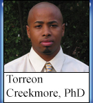
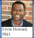
Doctoral Graduates from CERSER |
|
|
| |
   |
 |
| |

|
|
| |
|
| |
| |
|
|
|