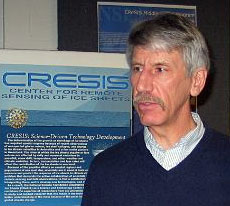
| IEEE-GRSS Lecture | STELLA Training | Dr. Robert Bindschadler | NASA GSFC |
| 2:30pm March 20, 2007 :: 229 Dixon Hall :: Elizabeth City State University
IEEE Geoscience and Remote Sensing Society (GRSS) Meeting And IEEE-GRSS Distinguished Lecture Series |
|
|
|
The West Antarctic ice sheet continues to be a climatic wild card in scientists' attempts to predict the future of the planet. The mystery rests as much on what we do know about ice sheets as what we don't know. The West Antarctic ice sheet rests on a bed below sea level where ice-free periods have layered a bed of thick marine ooze. Ice can, and does, slide rapidly on this slippery material. All other ice sheets of this type have slid back into the ocean, raising sea level over 100 meters. Will the West Antarctic ice sheet be the last to go? If it happens as rapidly as its icy kin disappeared, a potential 5-meter increase in sea level around the globe could occur fast enough to cause widespread economic and ecological damage. Others have argued that the West Antarctic ice sheet is uniquely stable pointing to its persistence in our warm climate. The study of the peculiar case of West Antarctica has been full of fascinating discoveries. These have come through a combination of wearying field work in a hostile environment, intense scrutiny from a vast stable of satellite sensors and complex numerical models. Remote sensing data are used for everything from making better maps of field areas, to quantifying surface elevations and velocities. Detailed imagery also allows us to detect surface features that record past flow directions. Twenty-five years of concentrated research have revealed a multifaceted dynamic system that responds to what falls on it, what it rests on and what it must push against. The ice sheet is changing constantly and is a collage of different basins all behaving with a high degree of independence. But what of its future?
|
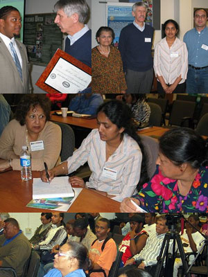
Dr. Linda B. Hayden, Director of The Center for Remote Sensing Education and Research (CERSER), is leading ECSU's efforts in this partnership with Dr. Prasad Gogineni, the Director of the Center for Remote Sensing of Ice Sheets (CReSIS). The CERSER Lab is focused on developing innovative and relevant research collaborations concentrating on coastal, ocean, and marine research. The CERSER Lab utilizes a TeraScan® High Resolution Picture Transmission (HRPT) System which includes a Polar Orbiting Tracking 1.5m Antenna, Global Positioning System (GPS) Antenna/Receiver, Telemetry Receiver, and the TeraScan® software suite. The National Science Foundation (NSF) supports basic research and education across all disciplines of science and engineering. The goals of the STC program incorporate developing a helpful means for lasting scientific and technological research and education. The STC program supports proposals it considers as important investigation at where research disciplines intersect. |
ECSU Undergraduate Research Experience 1704 Weeksville Road, Box 672, Elizabeth City, North Carolina 27909 Phone (252) 335-3696 Fax (252) 335-3790 |
Elizabeth City State University does not endorse, sponsor or provide material located on this site. |
 The Spring 2007 IEEE-GRSS Distinguished Lecture Series was held in the Center of Excellence in Remote Sensing Education and Research (
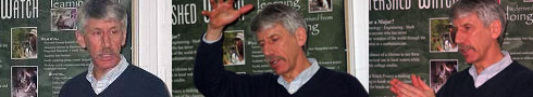
 The Lectures Series was preceded by a meeting of the
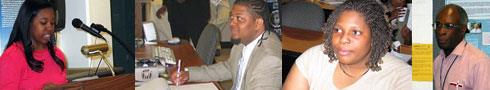
 Understanding the West Antarctic Ice Sheet from Space: Beyond Dogsleds and Frozen Toes
 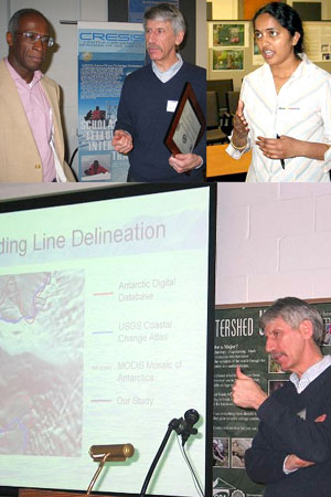 Sponsored by