| Workshop
Descriptions
EARTH: Pixoneer Software for Remote Sensing Education
Dr. Mohamed Mohamed
The purpose of the workshop is to introduce and discuss a remote
sensing class curriculum using EARTH software by Pixoneer. This
course provides an introduction to electromagnetic spectrum, basic
spectral properties of earth surface features, energy interaction
with the atmosphere, and spectral response patterns of surface features.
It also provides an overview of electro-optical remote sensing systems
including airborne and space-borne photographic cameras, multi-spectral,
thermal, and hyper-spectral sensors. The emphasis is on digital
data formats and characteristics, as well as background on photogrammetric
procedures and techniques used in image rectification, image enhancement,
image classification, and integration of remote sensing and geographic
information systems (GIS).
Organization and Visualization of Large Datasets in Remote
Sensing Digital Libraries
Dr. K. Palaniappan and Joshua Fraser
Two visualization software tools will be described - the DISS and
Kolam and hands-on examples of working with large datasets will
be demonstrated. The Distributed Image SpreadSheet (DISS) is an
interactive scientific visualization and analysis tool that provides
a novel gridded multiwindow interface for constructing, organizing,
and intercomparing gigabyte-sized datasets. The DISS provides convenient
networked storage access to remote sensing digital libraries. Highly
interactive visual browsing tools, such as multicell synchronized
animation, roam and zoom, stereoscopic display, navigated data probing,
surface rendering, flightpaths and volume visualization for interacting
with arbitrary-sized multidimensional data in each frame of the
DISS have been demonstrated for quickly inspecting thousands of
separate datasets. A unique DISS capability is to rapidly and smoothly
zoom, roam, animate and execute functions in synchrony for a large
set of 2-D or 3-D data cells.
Kolam is a tool for visualizing remote sensing datasets that are
tens of gigabytes in size with hardware-independent support for
adaptive compression and tiled image pyramid organization. Kolam
uses out-of-core visualization methods and a novel lightweight quad-bundle
data structure for accessing and displaying large 2D datasets, without
using hardware clip-textures or building a complete hierarchical
clip-map. Kolam uses multithreading, a novel cache management scheme,
and is very efficient in terms of texture loading, since the entire
viewport clip hierarchy is not updated. Kolam provides an electronic
softcopy or light table capability for very large datasets that
can scale to hundreds of gigabytes. Kolam is being used for visualizing
global multichannel MODIS mosaics with multiple layers that show
seasonal variations, global lights, landcover, snow and ice cover,
cloud cover, etc. Kolam can perform on the fly mosaicing of orthorectified
DOQ imagery and display embedded Landsat and statewide land cover
data. Kolam is being enhanced for high pixel density output for
supporting collaborative display wall capabilities.
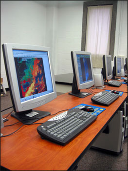
TeraScan Operations
Mr. Mike Crowley
Workshop topics will include but not limited to satellite, sensor,
and telemetry overview, TeraVision GUI for viewing and manipulating
processed satellite images, TeraMaster GUI for defining an area
of interest for your images and daily operating procedures of the
TeraScan system, including TeraCapCon and TeraTrackeye for pass
scheduling and capture, updating orbital elements; retrieving and
installing software patches; archiving data; TeraScan Log Viewer
for diagnosing and troubleshooting problems with data capture.
|