|
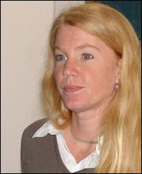
| Jennifer Aitken |
 Jennifer
Aitken has been working in the
field of airborne remote sensing
for 15 years, specializing in
data acquisition, analysis and
project management. Before graduating
from the University of Texas at
Austin in 1990 she began working
at Applied Research Laboratory
in Austin, Texas on high accuracy
kinematic GPS applications for
structural monitoring and aerial
photography. She moved to Canada
in 1992 and received a Master
of Science degree in Oceanography
in 1994 from the University of
British Columbia; her thesis topic
was wetland mapping with airborne
hyperspectral imagery. She continued
to work in airborne hyperspectral
imaging for the next ten years
specializing in centimeter-level
kinematic positioning, wetland
mapping and project management
of multi-sensor airborne data
acquisitions. Jennifer joined
Optech International as a research
scientist in July of 2004. Her
current research includes atmospheric
correction of hyperspectral imagery,
sensor fusion with bathymetric
lidar and production of seafloor
classifications. Jennifer
Aitken has been working in the
field of airborne remote sensing
for 15 years, specializing in
data acquisition, analysis and
project management. Before graduating
from the University of Texas at
Austin in 1990 she began working
at Applied Research Laboratory
in Austin, Texas on high accuracy
kinematic GPS applications for
structural monitoring and aerial
photography. She moved to Canada
in 1992 and received a Master
of Science degree in Oceanography
in 1994 from the University of
British Columbia; her thesis topic
was wetland mapping with airborne
hyperspectral imagery. She continued
to work in airborne hyperspectral
imaging for the next ten years
specializing in centimeter-level
kinematic positioning, wetland
mapping and project management
of multi-sensor airborne data
acquisitions. Jennifer joined
Optech International as a research
scientist in July of 2004. Her
current research includes atmospheric
correction of hyperspectral imagery,
sensor fusion with bathymetric
lidar and production of seafloor
classifications. |
|
|

