Dr. Kenneth C. Jezek
Biography
 Kenneth C. Jezek received the B.S. degree in Physics from the University of Illinois in 1973 and went on to receive M.S. and Ph.D. degrees in Geophysics from the University of Wisconsin , Madison where he studied the behavior of the Ross Ice Shelf Antarctica using ice sounding radar data collected during several visits to the Antarctic. Before joining Ohio State University ’s Byrd Polar Research Center , Dr. Jezek was a geophysicist with the U.S. Army Cold Regions Research and Engineering Laboratory. There, he researched the electromagnetic and acoustical properties of sea ice in the lab and in the Arctic . He also served a two-year period as manager of NASA’s polar oceans and ice sheets program. Dr. Jezek is the Principal Investigator on the RADARSAT-1 Antarctic Mapping Project. In June 2000, the RAMP team was the recipient of a NASA Group Achievement Award for its comprehensive study of the Antarctic continent. Kenneth C. Jezek received the B.S. degree in Physics from the University of Illinois in 1973 and went on to receive M.S. and Ph.D. degrees in Geophysics from the University of Wisconsin , Madison where he studied the behavior of the Ross Ice Shelf Antarctica using ice sounding radar data collected during several visits to the Antarctic. Before joining Ohio State University ’s Byrd Polar Research Center , Dr. Jezek was a geophysicist with the U.S. Army Cold Regions Research and Engineering Laboratory. There, he researched the electromagnetic and acoustical properties of sea ice in the lab and in the Arctic . He also served a two-year period as manager of NASA’s polar oceans and ice sheets program. Dr. Jezek is the Principal Investigator on the RADARSAT-1 Antarctic Mapping Project. In June 2000, the RAMP team was the recipient of a NASA Group Achievement Award for its comprehensive study of the Antarctic continent. |
Abstract
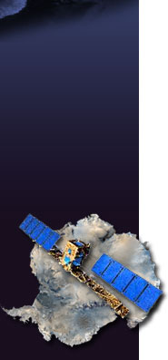
Antarctica is Earth’s coldest, windiest, and on average highest of continent. Because of its harsh climate and because it is often covered by clouds or shrouded in darkness during the long polar night, much of Antarctica remained poorly mapped till the end of the last decade. Then in 1997, NASA and the Canadian Space Agency embarked on a collaboration to obtain the first, high resolution synthetic aperture radar image of the southern continent. The first imaging campaign was successfully completed in October 1997 and achieved the primary goal of producing a stunning, new view of Antarctica . It revealed in unprecedented detail extensive networks of ice streams, the positions of ice divides and the ice margin, and even hinted about processes occurring at the base of the ice sheet. Following up on results from the 1997 effort, a second acquisition campaign occurred in the fall of 2000. Along with providing a second benchmark for measuring changes in ice sheet extent, the 2000 campaign collected interferometric data over much of the ice sheet. These data are being used to measure the surface velocity of the ice sheet, an important parameter for estimating ice sheet mass balance and for understanding the response of the ice sheet to changing climate.
This presentation summarizes results from the 1997 and 2000 imaging campaigns. In addition to describing glaciological processes captured in the image mosaics, the RADARSAT 1997/00 data are compared to assess spatial patterns in ice margin advance/retreat, which are themselves contrasted with earlier estimates of ice sheet behavior. Surface velocity data over newly discovered East Antarctic ice streams. These are used to estimate ice stream mass balance the role of these ice streams on the stability of the East Antarctic Ice Sheet.
Additional information on the RADARSAT-1 Antarctic Mapping Project is available at: http://www-bprc.mps.ohio-state.edu/rsl/radarsat/radarsat.html. |


